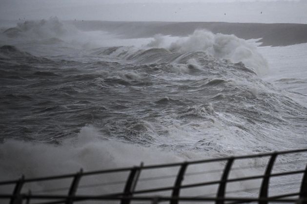
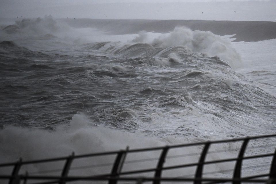
Had it happened a week earlier, tidal conditions combined with Éowyn’s hurricane-force winds would have created storm surges more than five metres high in densely populated areas.
Huge waves would have crashed far inland and left large areas under several metres of sea water.
Galway and Limerick cities, and Shannon Airport would have been badly hit.
The near-miss is revealed in analysis by scientists at University of Galway that shows the January storm’s ferocious winds created the highest storm surges ever recorded at key locations along the west coast.
The worst of the surges struck during a low and ebbing tide. If they had happened hours earlier, severe flooding would have resulted.
Today’s News in 90 Seconds – April 22nd
Had they hit a week before, when the twice-monthly spring tide was in full flow, an unprecedented disaster would have occurred. “It is hard to imagine how narrowly we avoided unprecedented storm surge flooding and an inundation,” Dr Indiana Olbert, from the School of Engineering at University of Galway’s College of Science and Engineering, said.
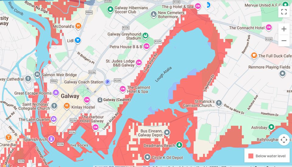
Data from scientists at the University of Galway showing how parts of the city could have flooded
“The data we have recovered from the hours around Storm Éowyn shows just how narrowly tens of thousands of people avoided tidal inundation and threats to cities, towns and coastal communities.”
The research team highlighted data from three coastal locations during Storm Éowyn: Galway Port, Limerick Docks and Shannon Airport.
At Galway Port, the storm surge peaked at a record high of 2.6 metres above mean sea level, the average height of the sea surface.
At Limerick Docks the highest surge along the western coastline was recorded, reaching 2.99m above mean sea level.
At Shannon Airport, the tidal gauge recorded a surge of 2.7m.
Had these surges occurred a week earlier during the spring tide, the water levels would have been much higher.
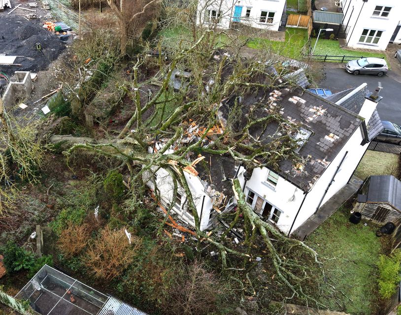
A house in Castleconnell, Co Limerick that was severely damaged by a large tree during Storm Éowyn. Photo: Don Moloney
At Galway Port it would have reached 4.96m; at Limerick Dock, 5.85m, and at Shannon Airport, 5.43m.
These places and many smaller coastal communities would have been suffered catastrophic flooding.
Dr Colbert said the near-miss should serve as a warning of what lies ahead in a changing climate as sea level rise continues, rainfall intensifies and storms become more severe.
“In future we will witness more extreme weather events that will result in devastating floods,” she said.
“Our analysis also shows that a rise in mean sea level rise will significantly increase the risk of coastal flooding.”
Dr Niall Madden, associate professor in Mathematical and Statistical Sciences at University of Galway, echoed that warning.
“In spite of how devastating Storm Éowyn was, in an odd way, we were incredibly lucky,” he said.
“Had it hit just a few hours earlier, on a full or flooding tide, Galway could have been dealing with a double disaster of record high winds and record high flooding.”
Storm Éowyn brought record-breaking winds to Ireland, with the highest gust, 184kmh and highest sustained wind speed, 142kmh, both recorded at Mace Head in Galway.
Buoys 30m out at sea recorded waves of more than 20m high.
#hard #imagine #narrowly #avoided #luck #timing #saved #cities #airport #catastrophe #Storm #Éowyn


